Uganik Island — Unganuuk
Uganik Island is a large, mountainous landmass on the western coast of the Kodiak Archipelago. It is the eighth largest island in the Kodiak region, covering approximately fifty-seven square miles. The island trends northwest to southeast, forming the northern limit of the Uganik Bay region and creating the southern coast of Viekoda Bay.
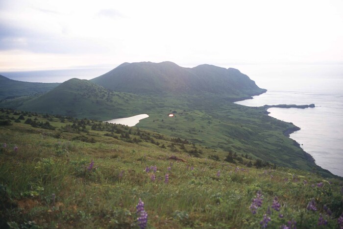
Uganik Island’s environment changes from north to south. The northern end of the island is mountainous, with steep peaks flanking the shore. This part of the island has a relatively straight, exposed coastline with long stretches of rocky cliffs and only a few protected bights. In contrast, Uganik Island’s southern third is lower and more protected. Here, mountains give way to rolling hills, tidal flats, lagoons, and small freshwater lakes.
Although the island’s protected shores may appear more inviting for settlement, archaeological data indicate that Alutiiq people used Uganik’s outer coast extensively. Cod fishing was their central activity. The waters at the mouth of Viekoda Bay and adjacent Kupreanof Strait support a cod nursery, an area where fish are abundant throughout the year. About 3,400 years ago, fishermen camped on Uganik Island to harvest this resource and dried quantities of cod for later use.
The name Uganik comes from the Alutiiq placename Unganuut, and it was first recorded in 1805 by Russian explorer Uri Lisianski. Russian traders misrepresented this name on maps. The Alutiiq name is either Unganuut or Unganuuk, not Uganik.