Viekoda Bay — Kangruiq
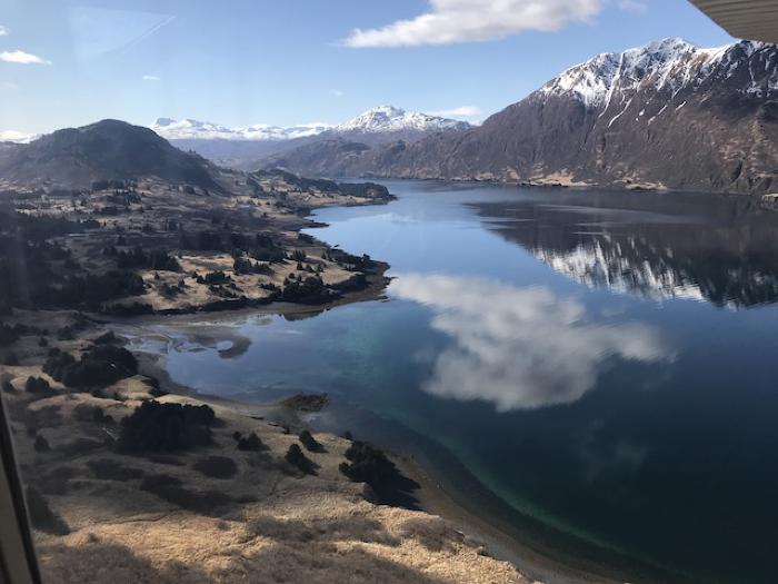
Viekoda Bay is a long, narrow fjord on the western coast of Kodiak Island. This body of water stretches about 29 km southeast from Shelikof Strait into the steep terrain of Kodiak’s interior. Here, mountains rise up to 2,800 feet above sea level behind a steep rocky coast. The northeastern shore of Viekoda Bay is formed by the Kupreanof Peninsula. This substantial finger of land separates Viekoda Bay from Kupreanof Strait to the north, an important passage between northern Kodiak Island and southern Afognak Island.
The name Viekoda comes from the Russian word “vykhoda” meaning Outlet Cape and appears on a Russian hydrological chart made in about 1839 by naval officer Mikhail Murashev. The name refers to the prominent cape at the northeastern entrance to the bay, at the tip of the Kupreanof Peninsula. The older, Alutiiq name for the bay is Kangruiq. This word comes from the root kange- meaning “head of bay,” or “source”.
The waters directly north of Uganik Island, at the mouth of Viekoda Bay, are a major halibut fishing ground and a place where Pacific cod congregate. Here cod do not migrate into deeper water in the winter but stay close to shore throughout the year. Archaeological studies illustrate that Alutiiq ancestors took advantage of these resources. About 3,500 years ago, people harvested, cleaned, and dried large quantities of marine fish at the Horseshoe Cove site creating a midden filled with stone tools, bones, and charcoal from alder and willow fires.